| |
|
|
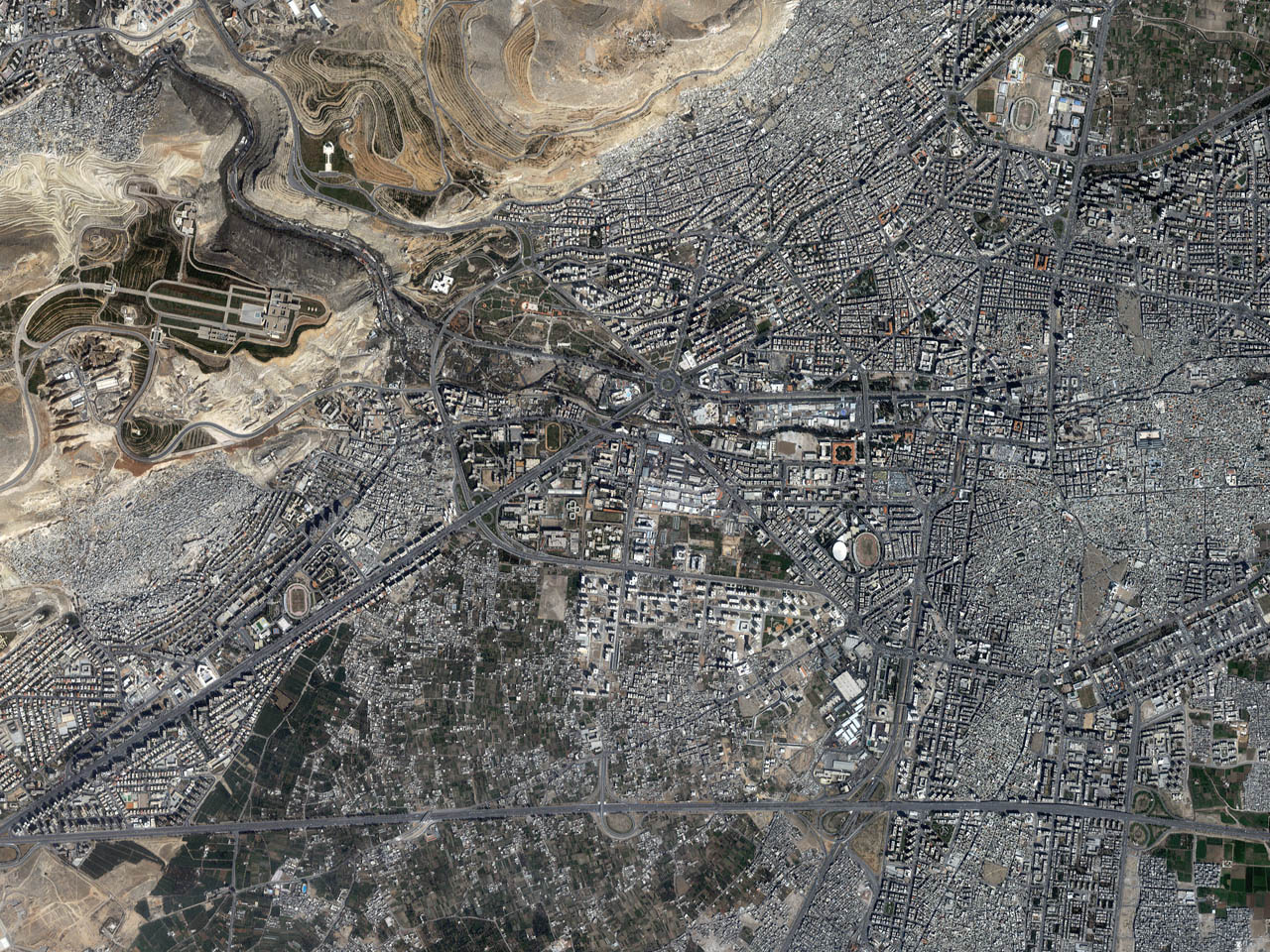
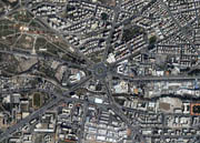
Damascus, Syria
|
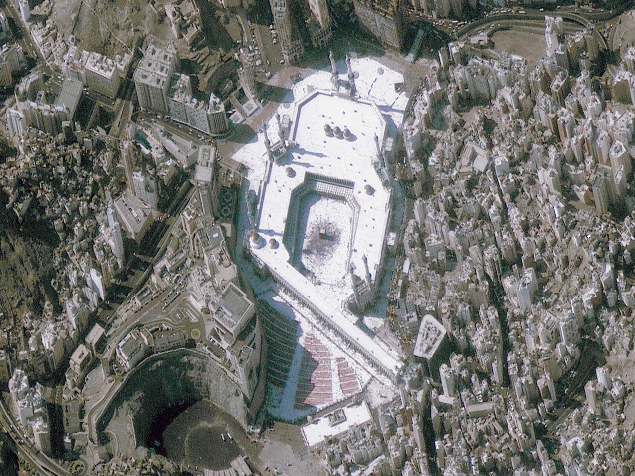
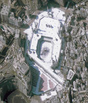
Mecca, Saudi Arabia |
 (520 Kb.)
Spaceimaging.com
The city design of Damascus, Syria is featured in this
four-meter resolution color image. The image was taken March
30, 2001 by Space Imaging's IKONOS satellite. |
 (320
Kb.) (320
Kb.)
Spaceimaging.com
Saturday, December 15, 2001 marks the end of the holy
month of Ramadan. Space Imaging's IKONOS satellite collected
this one-meter color image of Mecca January 1, 2000. The
image features the Ka'ba at Mecca. The image has been
rotated for ease of viewing. |
|
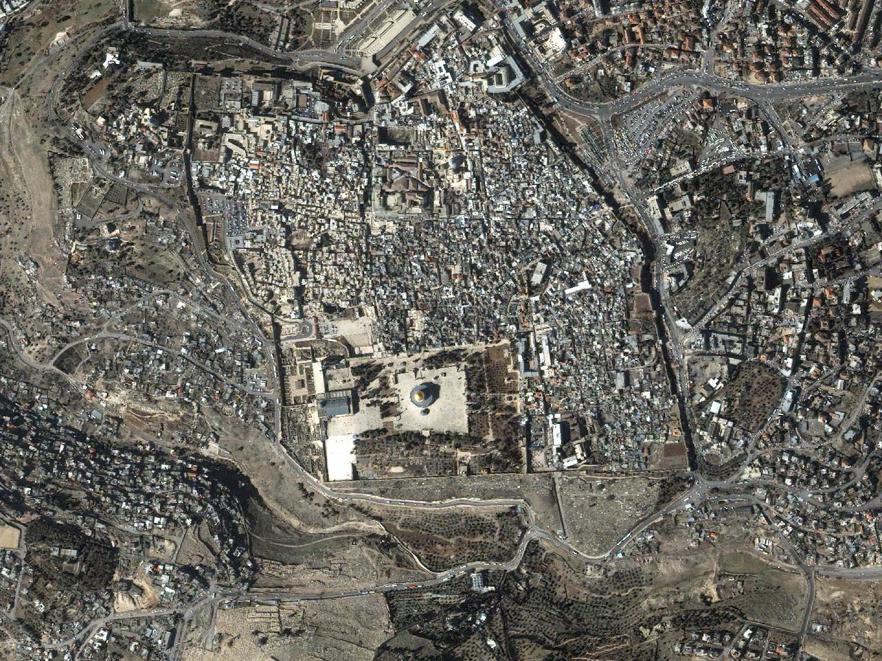
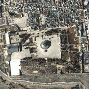
Jerusalem, Palestine (color)
February 15, 2000
IKONOS 2-meter |
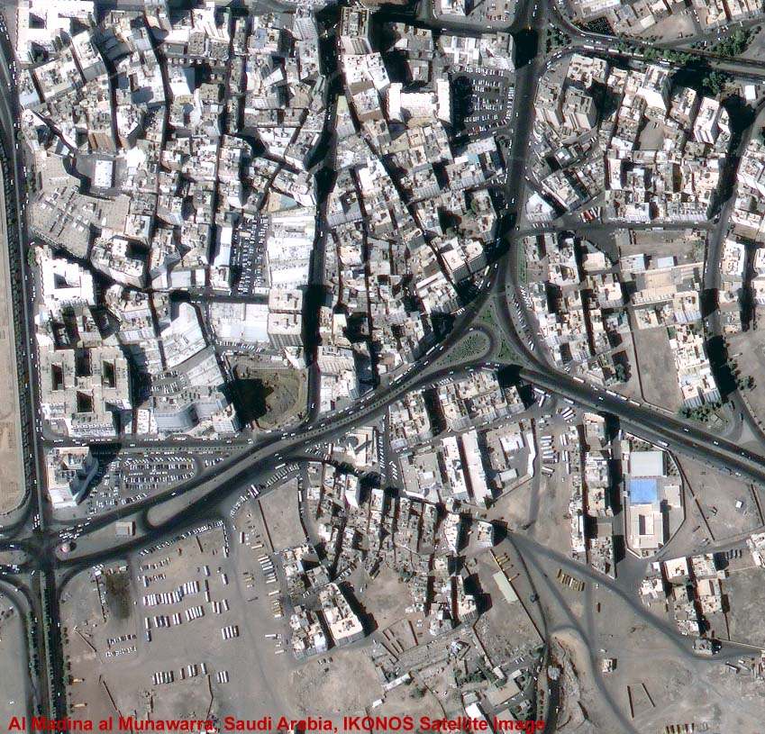
Al Madina al Munawarra
Saudi Arabia
Ikonos Satellite Image |
(430 Kb.)
Spaceimaging.com
International attention has been focused on the Middle East
the past few weeks. This resampled two-meter color image of
the Old Section of Jerusalem was taken February 15, 2000 by
Space Imaging's IKONOS satellite. |
Spaceimaging.com |
|
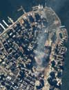
Manhattan, New York (color)
June 30, 2000
IKONOS 1-meter (pre-attack) |
Manhattan, New York
September 15, 2001
IKONOS 1-meter (aftermath image) |
Spaceimaging.com
One-meter resolution satellite image of Manhattan, New York
was collected June 30, 2000 by Space Imaging's IKONOS
satellite. The image, taken from the south, prominently
features the 110-story World Trade Center twin towers.
IKONOS travels 423 miles above the Earth's surface at a
speed of 17,500 miles per hour. |
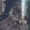
Spaceimaging.com
One-meter resolution satellite image of
Manhattan, New York was collected at
11:54 a.m. EDT on Sept. 15, 2001 by Space
Imaging's IKONOS satellite. The image
shows the remains of the 1,350-foot towers
of the World Trade Center, and the debris
and dust that has settled throughout the
area. Also visible are the many
emergency and rescue vehicles in the
streets in the vicinity of the disaster. |
|
Manhattan, New York
September 12, 2001
IKONOS 1-meter (aftermath image) |
Manhattan, New York
Summer
IKONOS 1-meter B/W overview (pre-attack) |
|
Spaceimaging.com
One-meter resolution satellite image of Manhattan, New York
was collected at 11:43 a.m. EDT on Sept. 12, 2001 by Space
Imaging's IKONOS satellite. The image shows an area of white
and gray-colored dust and smoke at the location where the
1,350-foot towers of the World Trade Center once stood.
|
Spaceimaging.com
One-meter resolution satellite image of Manhattan, New York
was collected at Summer 2001 by Space Imaging's IKONOS
satellite. The image shows of Manhattan. |
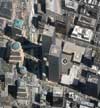
The Pentagon
December 28, 2000
IKONOS 1-meter (pre-attack) |
The Pentagon
September 12, 2001
IKONOS 1-meter (aftermath image) |
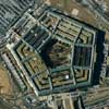
Spaceimaging.com
One-meter resolution satellite image of The Pentagon was
collected on Dec. 28, 2000 by Space Imaging's IKONOS
satellite. Clearly visible are the cars in the parking lot,
the Pentagon's renowned five-sided shape, the building's
inners rings and five-acre courtyard. |
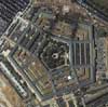
Spaceimaging.com
One-meter resolution satellite image of the Pentagon was
collected at 11:46 a.m. EDT on Sept. 12, 2001 by Space
Imaging's IKONOS satellite. The image shows extensive damage
to the western side and interior rings of the multi-ringed
building. |
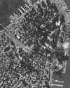
Manhattan, New York
Summer 2001
IKONOS 1-meter B/W overview
(pre-attack) |
|
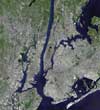
Spaceimaging.com
This
30-meter, low-resolution color satellite image of Manhattan
and the New York City area was collected in the summer of
1997 by the Landsat 5 satellite. The satellite was operated
by Space Imaging of Denver, Colo. |
|