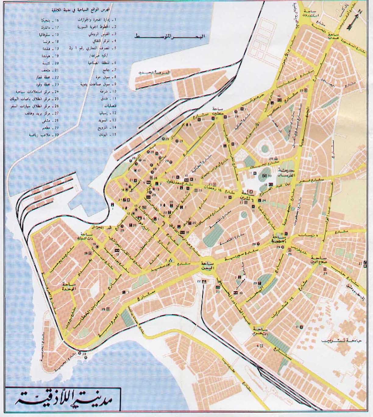
Introduction:
Latakia (Al ladhiqiyah) Is main sea-port of
Syria on the Mediterranean. It is
situated on the low-lying Ra's Ziyarah promontory that projects
into the Mediterranean Sea. It was known to the Phoenicians as
Ramitha and to the Greeks as Leuke Akte. Its present
name is a corruption of Laodicea, for the mother of Seleucus II
(3rd century BC).
Latakia lies 186 km southwest of Aleppo,
186 km northwest of Homs and 348 km
northwest of Damascus.
Latakia has retained its importance since ancient times. As
Latakia is the sea-gate to Syria,
It is well-provided with accommodation, and is well-placed as a
base from which to explore the coastal regions of the country.
There are beaches, mountains, archaeological sites and many relics
of the Crusaders, all within a few hours from each other.
History
Ancient Ramitha replaced the earlier settlement of
Ugarit (Ras Shamra) to the north, which
was destroyed in the 12th century BC. Latakia only came to
prominence in the wake of Alexander the Great's conquest, when is
was transformed into a major city of the Seleucid empire.
Renamed in honour of Loadicea, the mother of Alexander the Great's
general Seleucus I Nicator (3rd and 2nd centuries BC), it
developed into an important port and becoming the main supplier of
wine to the Hellenistic period. The town was briefly declared
capital of Syria
in the late second century AD by Septimius Severus.
Devastating earthquakes in 494 and 555 badly damaged Latakia, but
was rebuilt by Justinian. Latakia was taken in AD 638 by the
Arabs, in 1097-1103 by the crusaders, and in 1188 by Saladin.
Subsequently the town was administered by Christians from Tripoli,
Muslims from Hama,
and the Ottoman Turks; it came within the French mandate of Syria
and Lebanon in 1920.
Attractions and historical building
Some attractions in the city include a museum, that was an
old Ottoman khan which served as the governor's residence during
the French mandate. The museum houses some interesting
examples of pottery, glassware, clay tablets from nearby Ugarit,
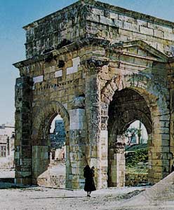
and contemporary paintings. Another attraction to the city
is a Roman gateway (Tetraparticus) that consists of four
columns.
The Syrian seashore is about 182 km long and its numerous beaches
are distinguished by soft sand, unpolluted sea, moderate climate
and clear blue skies. The Blue Beach of Latakia is
the most popular beach on the Eastern Mediterranean.
Water-skiing, jet-skiing, and windsurfing are popular activities
in this resort town. Nearby are two hotels, the Cham Cote
d'Azur Hotel and L'Merdien Latakia Hotel.
The Syrian coast consists of long stretches of beaches and green
mountains. These mountains are mostly covered with pine and oak
trees, and their slopes touch the shore. This landscape repeats
itself from Ras Al-Basit in the north to
Tartus in
the south. On the mountains, villages and towns are scattered,
with springs of clear mineral water.
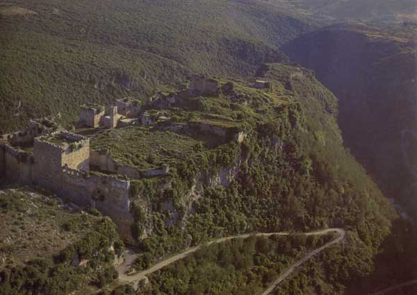
Surrounding attractions, include Ugarit
at Ras Shamra, Qalaat Saladin - a formidable castle that
has been well preserved, Slunfeh, Kassab and Ras
al-Bassit.
Economy
Latakia is now the principal port of
Syria; it is located on a good harbour, with an extensive
agricultural hinterland. Exports include bitumen and asphalt,
cereals, cotton, fruit, eggs, vegetable oil, pottery, and tobacco.
Cotton ginning, vegetable-oil processing, tanning, and sponge
fishing are local industries. The University of Latakia was
founded in 1971 and renamed Gami't Tishrin (University of October)
in 1976. The city is linked by road to
Aleppo,
Homs,
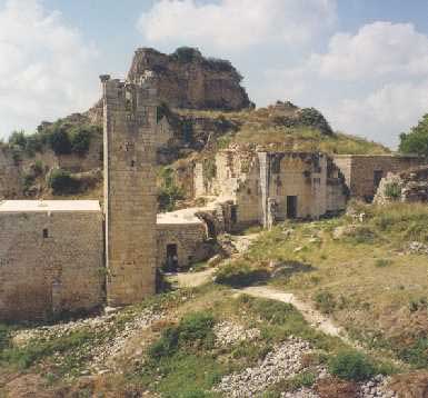
Tripoli, and Beirut. All but a few classical buildings have been
destroyed, often by earthquakes; those remaining include a Roman
triumphal arch and Corinthian columns known as the colonnade of
Bacchus.
Latakia governorate has an area of 887 sq mi (2,297 sq km) and
embraces Syria's fertile Mediterranean coastal area. It is an
important agricultural region, producing abundant crops of
tobacco, cotton, cereal grains, and fruits.
|