Introduction:
Ar Raqqa or Ar Rakka is a city in north central
Siria located on the north bank of the Euphrates River, about 160
km east of Alepo. It is the capital of
the Ar Raqqa Governorate and one of the main cities of the
historical Diyar Mudar, the western part of the Jazira. Its
population is about 190,000 (2000 estimate).
History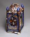
The Seleucid king Seleucos II Kallinikos (reigned 246-225 BC)
founded Ar Raqqa as the eponymous city of Callinicum or
Kallinikos. In the Byzantine period, the city was briefly named
Leontupolis by the emperor Leo I (reigned 457-474 AD), but the
name Kallinikos prevailed. In 542, the city was destroyed by the
invasion of the Persian Sasanid Shah Khusrau I Anushirvan (reigned
531-579), but was subsequently rebuilt by the Byzantine emperor
Justinian I (reigned 527-565).
In the 6th century, Kallinikos became a center of Syriac
monasticism. Deir Mār Zakkā, or the Saint Zacchaeus Monastery,
sited on the tell just north of the city, today's Tall al-Bi'a,
became renowned. A mosaic inscription there is dated to the year
509, presumably from the period of the foundation of the
monastery. Deir Mār Zakkā is mentioned by various sources up to
the 10th century. The second important monastery in the area was
the Bīzūnā monastery or 'Dairā d-Esţunā', the 'monastery of the
column'. In the 9th century, when ar-Raqqah served as capital of
the western half of the Abbasid empire, this monastery became the
seat of the Syriac Patriarch of Antioch.
In the year 18/639, the Muslim conqueror 'Iyād ibn Ghanm took the
Christian city Kallinikos by contract. Since then, it figured in
Arabic sources as Ar Raqqa, but still in Syriac sources
the name of Kallinikos remained. The strategic importance of Ar
Raqqah grew during the wars at the end of the Umayyad period
and the beginning of the 'Abbasid regime. Ar-Raqqa lay on the
crossroads between Siria and Iraq
and the road between Damasco, Tadmur
(Palmira), the temporary caliphal residence ar-Rusafa, ar-Ruha'
(present day Urfa in Turkey) and the Byzantine and Caucasian
theaters of raids and wars.
In 771-2 the Abbasid caliph al-Mansur built a garrison city about
200 metres to the west of ar-Raqqah for a detachment of his
Khorasanian Persian army. It was named ar-Rāfiqah, "the
companion". The strength of the Abbasid imperial military is still
visible in the impressive city wall of ar-Rāfiqah.
Ar-Raqqah and ar-Rāfiqah merged into one urban complex, larger
than the former Umayyad capital Damasco. In 796, the caliph Harun
al-Rashid decided for ar-Raqqah/ar-Rafiqah as his imperial
residence. For about thirteen years ar-Raqqah/ar-Rāfiqah was the
capital of the Abbasid empire stretching from Northern Africa to
Central Asia, while the main administrative body remained in
Baghdad. The palace area of ar-Raqqah covered an area of about 10
square kilometres north of the twin cities. One of the founding
fathers of the Hanafi law school, Muhammad ash-Shaibani, was chief
qadi (judge) in ar-Raqqah. The splendour of the court in ar-Raqqah
is documented in several poems, collected by Abu al-Faraj al-Isfahāni
in his "Book of Songs" (Kitāb al-Aghāni). Only the small, restored
so called Eastern Palace at the fringes of the palace district
gives an impression of Abbasid architecture. 8 km west of
ar-Raqqah lay the unfinished victory monument called Herakla from
the period of Harun al-Rashid. It is said to commemmorize the
temporary conquest of the Byzantine city Herakleia in Asia Minor.
It is a substructure of a square building in the centre of a
circular walled enclosure 500 m in diameter.
After the return of the court to Baghdad in 809, ar-Raqqa/ar-Rāfiqah
remained the capital of the western part of the empire including
Egypt. During the period of the Hamdānids in the 940s the city
declined rapidly.
Ar Raqqa lived a second blossom, based on agriculture and
industrial production, during the Zangid and Ayyubid period in the
12th and first half of the 13th century. Most famous is the
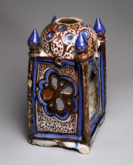
blue-glazed so called Raqqa-ware, which can be seen in many
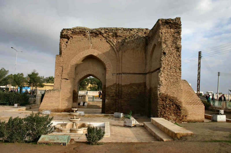
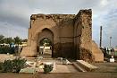
Museums in the world. The still visible Bāb Baghdād (Baghdad Gate)
and the so called Qasr al-Banāt (Castle of the Ladies) are
splendid witnesses for this period. Ar-Raqqah was destroyed during
the Mongol wars in the 1260s. There is a report about the killing
of the last inhabitants of the urban ruin in 1288.
In the 16th century, Ar Raqqa again entered the
historical record as an Ottoman customs post on the Euphrates. The
eyalet (province) ar-Raqqah (Ottoman form sometimes spelled as
Rakka) was created, however the capital of this eyalet and seat of
the vali was ar-Ruhā' (Edessa, present day Urfa in Turkey) about
200 km north of ar-Raqqah. In the 17th century the famous Ottoman
traveller and author Evliyâ Çelebi only noticed Arab and Turkoman
nomad tents in the vicinity of the ruins. The citadel was
partially restored in 1683 and again housed a janissary
detachment; over the next decades the province of Raqqah became
the centre of the Ottoman Empire's tribal settlement (iskân)
policy.
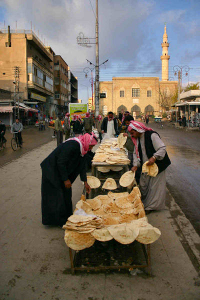
The city of Ar Raqqa was resettled from 1864 onwards,
first as a military outpost, then as a settlement for former
Bedouin Arabs and for Chechens, who came as refugees from the
Caucasian war theaters in the middle of the 19th century. An
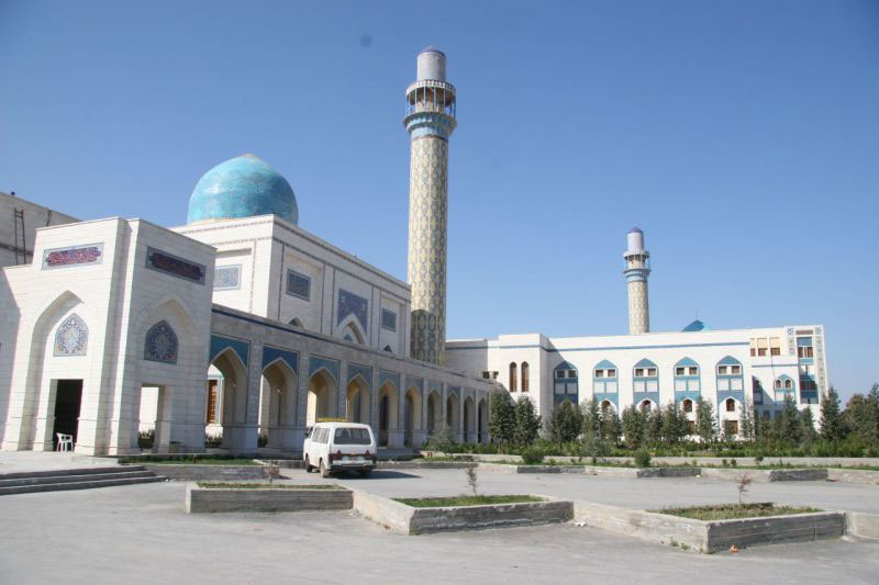
administration-building was erected during the French Mandate. It
houses nowadays the Museum of Ar Raqqa. In the fifties of the
twentieth century, in the wake of the Korean war, the world wide
cotton boom stimulated an unpreceded growth of the city, and the
recultivation of this part of the middle Euphrates area. Cotton is
still the main agricultural product of the region. The growth of
the city meant on the other hand a removal of the archaeological
remains of the cities great past. The palace area is now almost
covered with settlements, as well as the former area of the
ancient ar-Raqqa (today Mishlab) and the former Abbasid industrial
district (today al-Mukhtalţa). Only parts were archaeologically
explored. The 12th-century citadel was removed in the 1950s (today
Dawwār as-Sā'a, the clock-tower circle). In the 1980s rescue
ecavations in the palace area began as well as the conservation of
the Abbasid city walls with the Bāb Baghdād and the two main
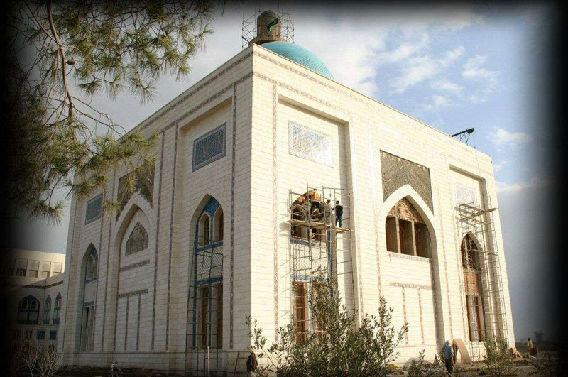
monuments intra muros, the Abbasid mosque and the Qasr al-Banat.
|