|
|
|
Deir ez Zor is situated 85 km to
the northwest of the archaeological remains of
Dura-Europos and 120 km northwest of
the remains of the ancient city of Mari.
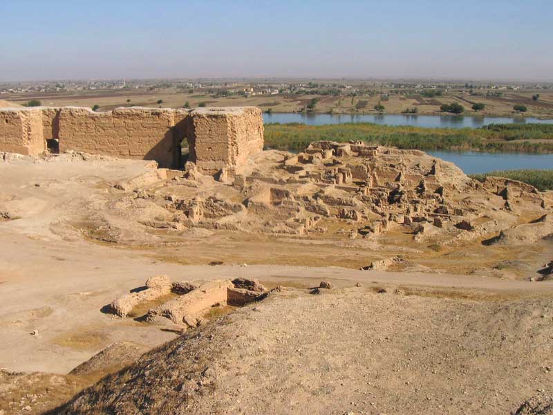
Dura-Europos ("Fort Europos")
was a Hellenistic and Roman walled city built on an escarpment
ninety meters above the right bank of the Euphrates river. It is
located near the village of Salhiyé, in today's Siria.
It was founded in 303 BC by the Seleucids on the intersection of
an east-west trade route and the trade route along the Euphrates.
The new city, commemorating the birthplace of Alexander's
successor Seleucus I Nicator, controlled the river crossing on the
route between his newly founded cities of Antioch and Seleucia on
the Tigris. Its rebuilding as a great city built after the
Hippodamian model, with rectangular blocks defined by
cross-streets ranged round a large central agora, was formally
laid out in the 2nd century BC.
The traditional view of Dura-Europos as a great caravan city is
becoming nuanced by the discoveries of locally made manufactures
and traces of close ties with Palmira.
During the later second century BC it came under Parthian control
and in the first century BC, it served as a frontier fortress of
the Arsacid Parthian Empire, with a multicultural population, as
inscriptions in Greek, Latin, Aramaic, Hebrew, Syriac, Hatrian,
Palmyrenean, Middle Persian and Safaitic Pahlavi testify. It was
captured by the Romans in 165 and abandoned after a Sassanian
siege in 256-257. After it was abandoned, it was covered by sand
and mud and disappeared from sight.
Mari (modern Tell Hariri) was an ancient
Sumerian and Amorite city, located 11 kilometers north-west of the
modern town of Abu Kamal on the western
bank of Euphrates river, some 120 km southeast of
Deir ez Zor, Siria. It is thought to
have been inhabited since the 5th millennium BC, although it
flourished from 2900 BC until 1759 BC, when it was sacked by
Hammurabi.
Mari had been inhabited since the 5th millennium BC, but the real
significance of the city was during the third and second millennia
BC. The inhabitants of Mari were a Semitic people, thought to be
part of the same Eblaite and Akkadian migration.
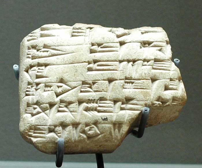
The Mari Tablets are a large group of tablets discovered by French
archaeologists in the 1930's. More than 23,000 tablets were found,
which gave information about the kingdom of Mari including the
customs of the Mari kingdom, as well as giving names of people who
lived during that time.
|
|
|
|